Pages

Monday, April 15, 2013

Genesee West Seattle

After recent industrial area walks, today's 10.3 mile walk through the Genesee neighborhood of West Seattle was a welcome change. I walked streets between 35th and 46th Avenues SW from SW Andover to SW Alaska Streets.

California Avenue has lots of shops and restaurants while Fauntleroy Way SW has dry cleaners, automotive services and a Trader Joe's.

The streets surrounding the intersection of California and Alaska are referred to as the Junction. The nearby area appears to be the social and commercial hub of West Seattle and has a friendly feel.

I spotted a number of murals,


construction, lots of new, large, mixed-use buildings, townhouses


and apartment buildings.


A block or two removed from California, I passed some lovely homes and gardens.

This area is home to the West Seattle Senior Center, Twilight Artist Collective, Hiawatha Community Center and Dakota Place Park,


the Antique Mall of West Seattle, West Seattle Eagles Aerie and Auxiliary No. 2643, Seattle Fish Company, Shoofly Pie Company, West Seattle Bowl and Buddha Ruksa Restaurant.


There are quite a few churches, in pretty close proximity to each other. They include Holy Rosary Catholic Church (plus K-8 School and Parish Center),


Eastridge Church,


Hope Lutheran Church Church (plus Preschool and Seattle Lutheran High School),


Faith Lutheran Church,


West Seattle Christian Church (plus its Ginomai Artist Community),


West Seattle Baptist Church,


Later Day Saints Church


and Tibbetts United Methodist Church.


Along the way, I spotted a water tower,
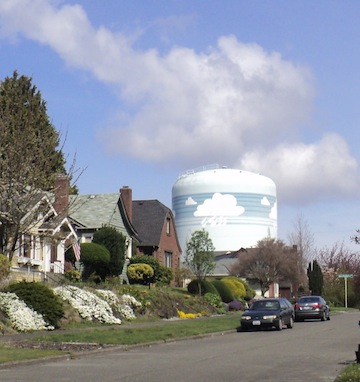


lots of of alleys, a free parking lot for shoppers at the Junction, some lovely homes and creative and colorful landscaping.


It was great to be back walking in a residential neighborhood with a charming business district. I even stopped to browse in a few shops and used book stores.

Wednesday, April 3, 2013

Georgetown - Periphery of Boeing Field


King County International Airport (a.k.a. Boeing Field) extends beyond Seattle so, at times, today's 9.3 mile walk took me into unincorporated King County. There were no signs indicating that I was leaving or re-entering the city but my map indicates that a long stretch of E Marginal Way S is outside the city limits.

My walk started at Ellis Avenue S and East Marginal Way S. Walking southeast along E Marginal Way, I was surrounded by Boeing facilities. At 16th Avenue, I walked south to view the progress of the bridge to South Park.

Returning to Marginal Way, I was beside the railroad tracks and spotted a pedestrian underpass which would take me to the east side of Marginal Way where I could walk on sidewalks. I was about to take a picture of the underpass when a young woman asked me what I was doing. When I explained, she said I was not allowed to take pictures of any Boeing property and the underpass was Boeing property. She said I could use the underpass but not photograph it. I proceeded south and, in less than five minutes, a security guard drove up to me, got out of his car and told me that he had a report that I had been photographing Boeing property and asked to see my pictures. He indicated that I could not take pictures along Marginal Way but I could take pictures on the other side of the airport along Airport Way. I will report that I saw large buildings, bus stops designed to handle large crowds, the Boeing Headquarters, the Museum of Flight and buildings belonging to the Aviation Technology Department of South Seattle Community College and Highline Aviation High School. I didn't see anything I considered secret or sensitive but I stopped taking pictures until I was on the other side of the airport.
I took S Norfolk Street to Airport Way and turned south to reach the city limit (I had to guess where it was). Turning to walk back north along Airport Way, the wind and passing cars almost blew my hat off. I was distracted grabbing for my hat and tripped over a large cement block. When I got up and resumed my walk, I noticed that a concerned motorist had pulled over and waited to see that I was OK before taking off. I was nice to feel cared for after having felt suspected. Airport Way runs parallel to the railroad tracks.

Continuing north, Perimeter Road S runs parallel to Airport Way. Where the two roads are only separated by a green strip, I walked the green strip. Where they are separated by buildings or parking lots, I walked both roads.

I passed the King County International Airport Terminal, Kenmore Air, US Customs and Border Protection, Clay Lacy Jets, Hertz, Northwest Helicopter Tours, Galvin Flying, the Aviator's Store, American Avionics, Ameriflight and Erin Air before reaching the northern end of the field ...


...and noticing that the Boeing Field Apartments had vacancies. It was a pretty noisy area (mostly from helicopters on this spring morning) so I'm not surprised.

I headed west at Ruby Chow Park

and came to the southern edge of the Georgetown residential and business area where I noted the Runway Cafe and Tavern,


Image Custom Iron Works


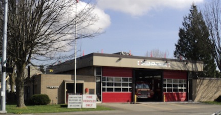
and Fire Station 27.

King County International Airport seemed like a sleepy, small town airport and I'm still wondering what might be going on there that I shouldn't photograph. No one tried to stop me from looking.

Monday, April 1, 2013

West, Lower and East Queen Anne and Interbay

Today's 6.6 mile walk was a 'clean up' walk in which I finished off a number of streets I had missed in Queen Anne and a piece of Alaskan Way in Interbay.

The first part of the walk started in East Queen Anne (near Aurora Avenue north of Mercer) and dipped into Lower Queen Anne. The area was mostly residential with a few businesses.

I observed


older apartment buildings,


newer lofts,


townhouses,


staircases, construction sites (along Aurora), condos, single family homes, a grill named Laredos,


Horizon Church,


a mural


and some creative landscaping. In spite of being close to Seattle Center, this was a pretty quite neighborhood.


The second part of the walk included West Queen Anne and Alaskan Way in Interbay. The eastern portion of this area had lovely homes and views. I passed (and climbed) staircases - one with a sign that indicated it had been built in 1939-1940 as part of the Works Public Administration.


I walked through the Southwest Queen Anne Greenbelt and noted an interestingly designed slide.


The western portion of this area included 15th Avenue and Elliott Avenue W which are busy commercial streets with quite a few building supply stores, Whole Foods, the Interbay Postal Annex, the Wine Outlet, a few large furniture consignment shops and the Amgen Helix Bridge. I crossed the bridge and walked the periphery of the attractive Amgen campus which led me to a bike path.


Along the way, I passed a tree decorated for Easter


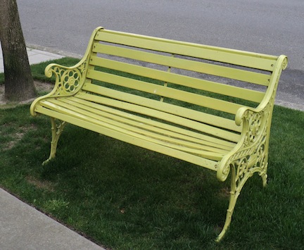
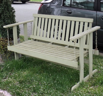
and some inviting looking benches. This was  a much more varied area.