

Today's 8.1 mile walk in the Industrial District is not one I'm likely to repeat. It had its points of interest but the area supports shipping and heavy industry and I vied with trucks for walking space. The truck drivers all seemed to notice a pedestrian but the area was dusty and had lots of pot holes.


There were signs of development and tidy streets with newer buildings and sidewalks
co-exist with railroad tracks.


I saw quite a few moving trains and heard train whistles blowing.


This is not a residential area but I did see two houses, one boarded up and the other, almost next door to it, looking pristine.
Along the way, I passed pot holes big enough to swallow small cars,
a
Big Brothers Big Sisters Donation Center, what looked like a taxi dispatch center, a
Starbucks Drive-Thru just south of a
Costco on 4th Avenue S,


a
City Light facility,
a colorful expresso stand in an unlikely place,
murals on the
UFCW 21 (a voice for working America) building
and the
Georgetown Morgue,
birds painted on the supports of the Spokane Street Viaduct,
a very large
Charlie's Produce trucking center,
a Seattle Fire Department facility (may be a temporary location), a
Pacific Sheet Metal facility,
what looked like a homeless encampment under the 1st Avenue S viaduct and a street being cleaned nearby.
I also observed a sign proposing to develop a large facility at Hudson and 1st, a sign above a large warehouse advertising
Sears Contract and Commercial Sales (Show Room/Design Center/Will Call),
Dirt Depot (Seattle's Premier Dirt Networking), a sign for an
Urban Enoteca (their website indicates they host weddings and events)
and signs of Spring.
Not my favorite walk but not without some rewards.


 It was back to the Industrial District, today, for an 8.4 mile walk along streets between I-5 and 4th Avenue S from S Spokane Street to Lucile Street. The main street in this area is Airport Way and parts of it were lined with trees and had nice sidewalks.


 This area is home to the City of Seattle Transportation Department Traffic Shops,


 A nicer walk than yesterday's but still pretty industrial.
 Today's 8.1 mile walk in the Industrial District is not one I'm likely to repeat. It had its points of interest but the area supports shipping and heavy industry and I vied with trucks for walking space. The truck drivers all seemed to notice a pedestrian but the area was dusty and had lots of pot holes.


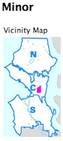
 My husband and I saw lots of churches today as we walked 5.3 miles in the Minor neighborhood. We saw vacant lots, murals, corner stores, P-Patches, social services facilities and newer construction too in this changing area.


 and the Eritrean Community Center which appears to be physically connected to and has probably taken over the adjacent Seventh Day Adventist Church.


