Pages

Monday, July 29, 2013

Arbor Heights Neighborhood of West Seattle

Today's 7.3 mile walk took me back to Arbor Heights and its spectacular views. The area I walked bordered on Arbor Heights Elementary School but, other than that, it was residential.

The area includes The Arroyos, 

with 39th Avenue SW leading to Arroyos Street,

the Arroyos Natural Area

and Arroyos Beach Place where I spotted a small private beach

and, possibly, another stand of Madrona trees.

Climbing back up the hill, I came to a scenic stretch of Marine View Drive and spotted a point where the utility wires went from overhead to underground.

Along the way, I chatted with a friendly resident who praised the neighborhood and said that people move in and stay. Some of the houses were on the water and many were on large lots and/or had great views. I saw an amazing tree,


a dog watering station, courtesy of Delsey the Wonder Dog,

some great gardens,


lots of overhead wires (but only on certain streets)

and the point where the southern segment (not connected to that north of Thistle) of California Avenue ends.

I'm starting to expect spectacular views and Arbor Heights delivers.

Thursday, July 25, 2013

Arbor Heights Neighborhood of West Seattle

The chance to walk with a friend who lives in the area brought me to Arbor Heights today for a 9.6 mile walk. This is a quiet, residential area situated at the Seattle city limits.

We walked south along the shady Seola Beach Drive, passing a sign welcoming us to the Seola Creek Watershed

and coming to Pump Station #8, the water and a private lane (SW Seola Lane) where homes were built along the waterfront. There was no public beach access on this dead-end street.

We noted what appeared to be trails in Seola Park

and what, I think, is a large stand of Madrona trees.

My friend had to get back to work (she's not retired as I am) but I continued walking, observing the Arbor Heights Swim and Tennis Club,

the New Apostolic Church,

Hillcrest Presbyterian Church (where a proposed land use action sign indicated that the Westside School wants to locate here replacing the church and school). I did see a signboard with the service schedule and a smaller signboard advertising services for the Iglesia De Jesuchristo Rey De reyes.

At its southern tip, 35th Avenue SW turns west and becomes Marine View Drive. I noted a sign for the Seola Greenbelt but, once again, there was no water access.

There were nice homes on the water side of Marine View Drive and here and there I caught a glimpse of the water.

The  triangular area between 35th and Marine View Drive has a sign reading "Welcome to Ocean View."

Along my walk, I was treated to great views of Mount Rainier and I saw some nice gardens and garden art.

This walk brought me into what felt like many inviting little enclaves and many dead-end streets. It was great to catchup with my friend and see her children again.

Tuesday, July 23, 2013

North Admiral Neighborhood of West Seattle

When I got to North Admiral, today, I realized that I had forgotten my camera. In this post, I will try to verbally describe the area. I walked 7.8 miles along streets north of Walker. Most of the streets were east of California but I included a few streets west of California north of Atlantic. Except for Harbor Avenue and the corner of California and Walker, this area is residential and pretty hilly; it includes a ravine.

I would have taken pictures of Admiral Congregational United Church, California Place Park, a house with a matching birdhouse out front, a lovely lavender colored house with a porch and white wicker accessories, raised vegetable beds in a parking strip and some lovely homes and great views.

There are quite a few condos/apartments/townhomes along California and the Park West Skilled Senior Center is also on California. At its southernmost point, California Avenue just seems to end but here in the north, it wraps around the tranquil Hamilton Viewpoint Park before veering downhill through a treed area and merging into Harbor Avenue. I noted quite a few people in their vehicles, relaxing and enjoying the view from the park. There is a plaque honoring the Genesee Hill Garden Club for their park beautification project.

On Harbor Avenue, I passed 
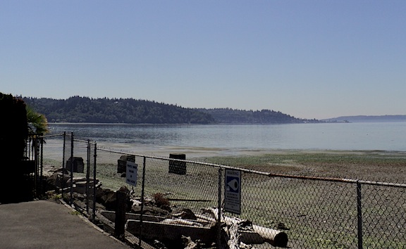
Seacrest Park with its fishing pier, Hawaiian/Korean restaurant, kayak/bike rental and Water Taxi dock. At the entry to the fishing pier, I spotted a plaque dedicated to the Tengu Club. This stretch of Harbor Avenue houses newer condos/apartments, Pacific Institute and a few older cottages - one with a nautical motif and a totem pole outside, another with a more zen feel and a rear garden going up a steep hillside.

I spotted scuba divers on the rocky beach and noted dedication plaques by benches along a park walkway.

At the intersection of Harbor and California, I saw a SDOT employee counting traffic flow (not sure if it was cars, bikes or pedestrians or all of them).

This was great walk, even without my camera.

Monday, July 22, 2013

Alki Neighborhood of West Seattle

There was a negative low tide today and I got to Alki Beach Park when the tide was going out.

I took pictures of a few landmarks I had missed yesterday including the Alki Bathhouse

and a 1/18th size replica of the Statue of Liberty. The Boy Scouts of America gave the original replica to the city in 1952; it was recast in 2004 and the new pedestal and the plaza (Statue of Liberty Plaza) were dedicated in 2008.

By the time I reached Constellation Park Marine Reserve, the tide was probably at its lowest and I couldn't resist being one of the people of all ages who were joining a naturalist on the beach. I spotted jellyfish, starfish, moon snail egg casings and even a crab.

Embedded in the sidewalk on the water side of Beach Drive are medallions which create The Avenue of the Stars.

Tearing myself away from the tide pools, I returned to Beach Drive SW and found myself at the 63rd Pump Station where I came across a sculpture which could not compare to the sea life I had just observed.

Proceeding on to Cormorant Cove Park, I had a good view of the stilts supporting the Harbor West Condos.

Next I passed Andover Place Public Shoreline Access

before arriving at Weather Watch Park where a monument offers educational information about weather words and the history of the area and the park.

Across Beach Drive, I spotted La Rusica Restaurant.

I zigged and zagged my way back to Alki Avenue, walking along streets, some flat and some quite hilly (I noted a few staircases). Homes near the tops of the hills had views and looked expensive. Homes on the flats appeared more modest and, once I was a block away from the water, I felt I could have been in many Seattle neighborhoods. Small cottages were being replaced by multiplexes but there were still comfortable looking older homes.

Along the way, I passed the Homestead

and the Log House Museum (open Thursday to Sunday from 12-4). A short history, posted on the porch, states that the original settlers wanted to make this area a big city and named it New York. The word Alki (meaning "by and by") was added when they realized that would take a long time. When the settlers moved to what is now downtown Seattle, this area became a vacation spot and was known as the Coney Island of the West.

I also passed Kol HaNeshamah synagog

attached to Alki Congregational United Church of Christ.

This area is home to the Alki Community Center,

an entrance to Schmitz Park,

lots of merchants along Alki Avenue

and the patron saint of those who scoop after their dogs.

This was a wonderful 8.1 mile walk and I got to visit a community I had not expected - the tide pools.