My husband and I returned to the Minor neighborhood, today, to fill in streets I had missed on prior walks. Our 5.3 mile walk took us from Garfield High School to Seattle University and around Swedish Hospital's Cherry Hill Campus and the King County Youth Detention Facility. Even though some nice single family homes and residential streets remain, this appears to be a neighborhood where institutions are squeezing people into denser housing units. We observed land use action signs proposing two new 3-story medical buildings for Swedish and new height and boundary adjustments for Seattle University.
"The 12th Ave Neighborhood Plan calls for developing 12 Ave into the 'main street' of the urban village. The James Ct woonerf, abutting 12th Ave, would help provide the kind of environment envisioned in the Neighborhood Plan.
The Opportunity Fund proposal envisioned the development of a woonerf along James Ct spanning between the 12th Ave Park to the south and the new Seattle University and Seneca group development to the north. A woonerf is a street where pedestrians and cyclists have legal priority over motorists. The techniques of shared spaces, traffic calming, and low speed limits are intended to improve pedestrian, bicycle, and automobile safety".
 This area is home to the Lighthouse Temple Church of God in Christ,
 Cherry Hill Baptist Church,
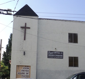
 Zion United House of Prayer,
 the Vietnamese Catholic Community,

the Gondar Mutual Association of Seattle (offering ESL and citizenship classes for the Ethopian/Gondar Community), a number of Ethiopian restaurants,
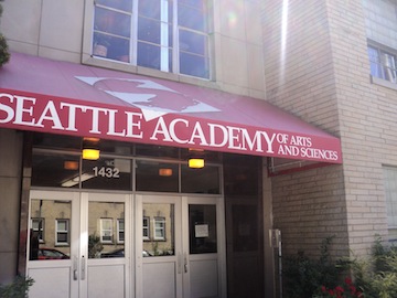
 Seattle University's Athletic facilities and playfields and its Center for Service and Community Engagement
 and Alder Academy of the Youth Detention Center
 with its large Spirit of Youth bronze sculpture; it represents the Salish heritage in Washington and the diverse ethnic background of this community. The placement of this 'dorsal fin' presents a metaphor of the submerged and partially visible spirit.
 This area borders Garfield High School, the new Quincy Jones Performance Center and the Garfield Community Center.
 We observed a vegetable garden planted outside a parking lot,
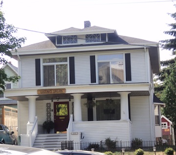
 the Northwest Kidney Centers, a house labeled Gustav's Salon (which is a hair salon)
 and admired murals on a garage,
 the old Providence buildings at Swedish's Cherry Hill Campus,
 some bus shelter art and Ezell's Chicken. I had my first sampling of Ezell's chicken to celebrate hitting the half way mark of these walks:-)
 This was a good walk on which to hit the 1600 mile count. I celebrated this mile marker by having my first Paseo pork Sandwich; it was every bit as good as I'd heard!


the Gondar Mutual Association of Seattle (offering ESL and citizenship classes for the Ethopian/Gondar Community), a number of Ethiopian restaurants,